Top: Home Page
Up: Table of Contents
Previous:
Next:
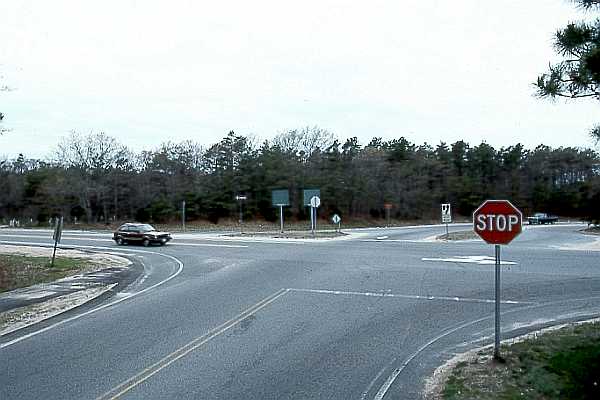
This path, most of which was built in the early 1980s, is a sidewalk-type path like many on the Cape. It is one of several which are hardly used at all by bicyclists, due to problems which this article will illustrate. The camera is looking west in the photo below. The path begins at Route 149, which passes from right to left in the picture. Old Stage Road enters from the bottom of the picture. The path is visible at the left side of the photo. The roadways beyond the stop sign are entrance and exit ramps for Route 6, which runs parallel to Old Stage Road, out of the picture to the right. Massachusetts bicycle Route 1 proceeds from the front of the picture to turn left onto Route 149 (where the car is in the picture) and then right again onto a frontage road for Route 6. The major safety issue here is that of bicyclists' having to make unusual and unexpected maneuvers to enter and exit the path. Notice also the sand on the path, due to poor drainage and the lack of the street-sweeping effect of motor vehicles. |

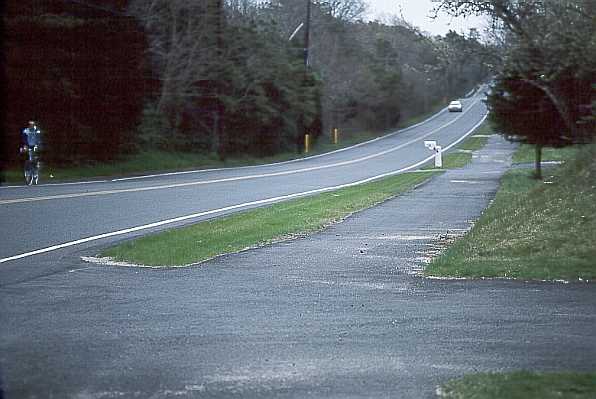
The path proceeds along the south side of Old Stage Road. The next photo looks east along the path. Note the bicyclist in the photo riding on the road, and the embankment at the right. |
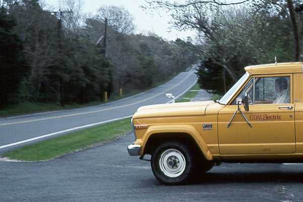
The next photo was taken at the same location a few seconds later. The ground is blurred in the picture because I was panning the camera to follow the truck, which did not stop before pulling out across the path While a pedestrian on the path would have been in the driver's field of view soon enough, a bicyclist traveling at normal road speed on the path would not have been. |
| The next photo looks northwest. There is a sharp corner on the path, just as it crosses another driveway. Then it goes up and down a steep little hill, where the road is flat. |
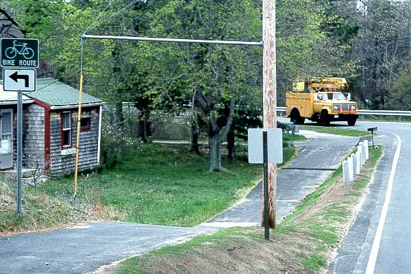
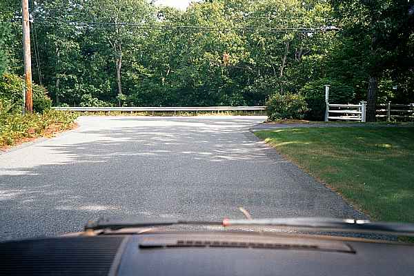
The path goes steeply down and then up again, so bicyclists rise out of concealment just as they cross another driveway in this 1985 photo. Guy wires of the two utility poles in the photo are placed immediately next to the trail where they can snag a bicyclist's pedal. |
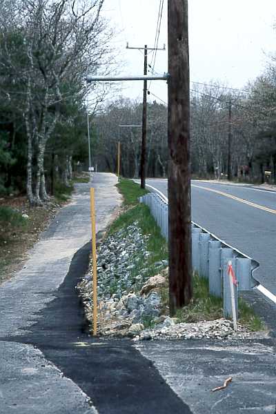
| As development proceeds, the path becomes less and less usable for bicycle travel. In 2001, at the same location, a new road has replaced the driveway. The new road is much wider and carries traffic to and from a new residential development. While bicyclists are instructed to stop here, there are no crosswalk markings. |
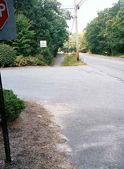
| As seen from the new road, there is no hint that a path or sidewalk crosses here. Vegetation seriously restricts sightlines. |
| As of 1985, the path ended at Race Lane with no crosswalk marking and with the stop sign and crosswalk line after the end of the path. |
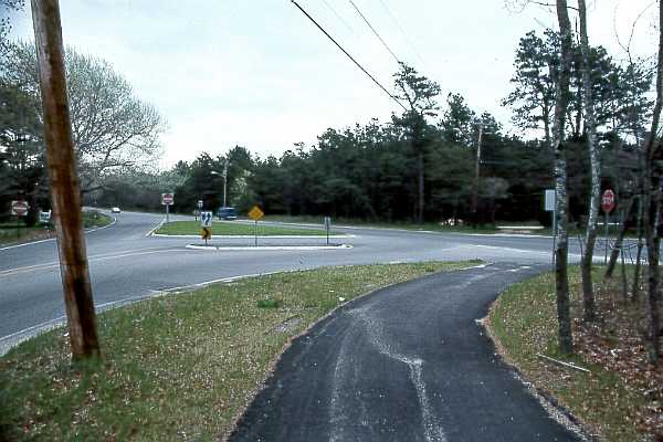
| As of 2001, the traffic islands have been redesigned, with new crosswalk markings across Old Stage Road and a sharper turn to slow right-turning traffic as shown in the photo below. The crosswalk configuration is better, but very few bicyclists other than children would be bothered with the delay involved in crossing here as pedestrians; yet most bicyclists here are adults.. |
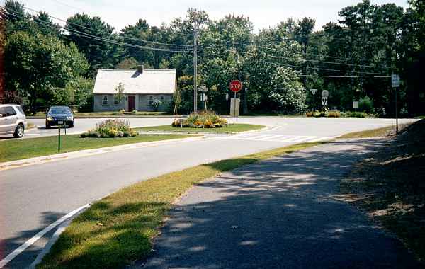
| The path has been extended beyond the intersection shown above, past a church driveway. At the left rear of the photo below, it crosses onto the traffic island which is visible behind the "do not enter" signs in the photo. |
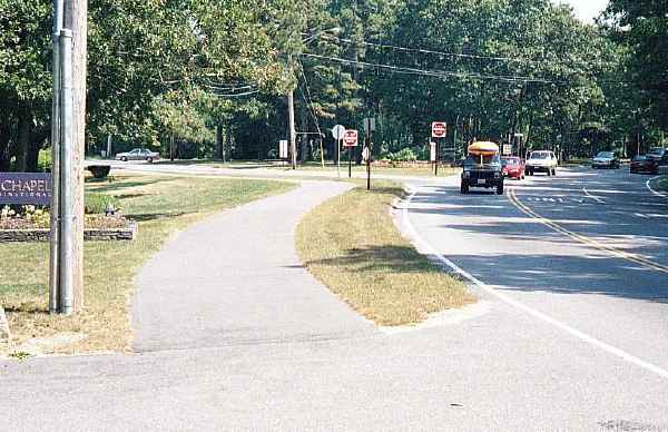
| The two-way path ends at the one-way roadway on the far side of the traffic island. The probable intent here is to install another crosswalk and continue the path down Old Stage Road, but for now, this installation offers no lawful way for bicyclists to continue from this location. |
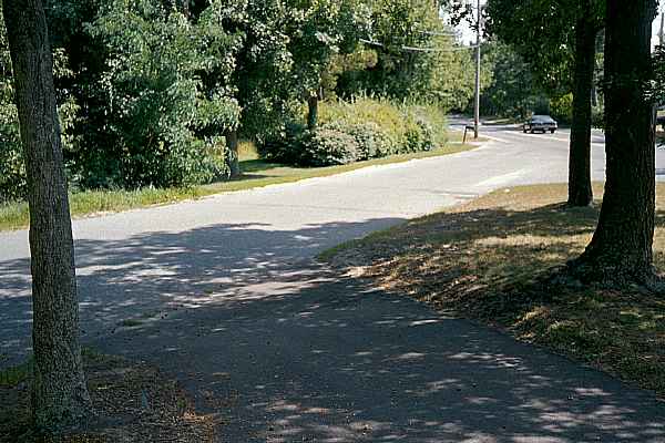
| This path is not even satisfactory as sidewalk; its slopes exceed standards for
wheelchair use. It is so hazardous and annoyingly slow for bicycle use that I have
never seen a bicyclist riding on it. The experienced bicyclists ride on the road, and the
novice bicyclists don't ride here at all. A more sensible treatment would have consisted of a slight widening of the road, and a narrower sidewalk. The total amount of paved area would have been no greater. |