(The links below will work better if you first click on the headline above so you are viewing only this single post).
Overview | Present Road Diet | Proposed Footprint |Crash Risks |
Operational Issues | Suggestions | Details | Summary
Overview
A Google map provides an overview of the stretch of Concord Avenue in Cambridge, Massachusetts, USA between Alewife Brook Parkway and Blanchard Road. You’ll get a better view if you close the address balloon.
View Larger Map
This article will describe an important improvement made to Concord Avenue around the year 2000, and another proposed change which I do not consider an improvement.
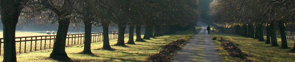
Concord Avenue and surroundings
Concord Avenue runs east and west. The south (eastbound) side borders the Fresh Pond Reservation — a large park, with the pond, a golf course, and trails. Only one driveway opens onto Concord Avenue on the south side, and it serves only a small nursing facility, Neville Manor.
The north side of Concord Avenue provides the only access to an industrial area, as the Fitchburg rail line forms a barrier to the north. 7 streets and 24 driveways T into the north side of Concord Avenue in this 3000-foot stretch — nearly one every 100 feet. Some of the driveways are very wide. The streets and driveways carry heavy commuter and business traffic. There are several large parking lots in the industrial area, and a couple of large parking garages. You may view these here and here. All in all, there is parking for about 1000 cars. Several businesses run heavy trucks.
Until approximately the year 2000, this segment of Concord Avenue had four lanes. These were too narrow for a bicyclist and motorist to share side by side.
The year 2000 road diet
Around 2000, Concord Avenue was restriped to three travel lanes (one westbound, two eastbound) and bike lanes, a major improvement. I prepared a Web page describing this change and expressing my approval.
Why did the road diet work?
Eastbound traffic can continue to move in the right lane and bike lane while left-turners wait in the center lane.
 Westbound traffic only needs to make left turns into the one driveway of the Neville Manor nursing facility — and at a signalized intersection, so a single westbound travel lane and bike lane are sufficient.
Thanks to the combined width of the right lane and bike lane on each side, motorists can easily overtake bicyclists without changing lanes. Eastbound traffic can overtake stopped buses, as is shown in one of the photos on my page.
Concord Avenue now provides a reasonable quality of service for experienced adult bicyclists — better eastbound than westbound, to be sure, because of the many driveways and streets on the north side.
(Update, November 28, 2012: the project is now complete.)
To reach the westbound bike lane from the path in Fresh Pond Park, it is necessary to cross Concord Avenue in a crosswalk. For this reason, and because of the much more challenging situation on the north side, some bicyclists prefer to ride on the sidewalk on the south side of Concord Avenue — especially, westbound. The sidewalk carries little pedestrian traffic, because it has so few trip generators.  I usually do not favor sidewalk riding, but the sidewalk on the south side is quite safe for bicyclists during daylight hours, as long as the bicyclists are traveling it end to end. I don’t recommend riding the sidewalk after dark — westbound cyclists are then facing the brighter side of motor-vehicle headlamp beams. After winter snowfalls, it is not rideable.
The proposed new footprint
The City now proposes a different footprint for Concord Avenue, moving the curbs inward, eliminating the bike lanes. Bicyclists are instead to ride at sidewalk level immediately behind high curbs — not the low Copenhagen-style curbs that can topple a bicyclist attempting to enter the bikeway, but 6-inch high curbs that can also throw a bicyclist who strays off the bikeway into the street.
The City has a brief description of the project on a Web page.
(Update, November 28,2012: Project documents and photos have been moved to a different location on the Cambridge city government Web site.)

New cross-section for Concord Avenue
That City Web page links to a cross-section drawing (also shown above — click on it to enlarge) and a conceptual drawing.
I strongly suggest an alternative design (see below), because of serious problems with the proposed design.
Crash risks
First of all, let’s be clear if you are not familiar with bicycle crash statistics: most car-bike collisions are due to crossing and turning conflicts. The widely-feared rear-end collision is rare, especially under urban conditions. It has been known since the 1970s that the two most common types of car-bike collisions are the “right hook” and the “left cross”. These are also the two most common causes of bicyclist fatalities in the Boston urban area.
The “right hook”

The right hook
A “right hook” collision may occur when a motorist overtakes a bicyclist on the left and immediately turns right. In this case, the motorist should have seen and yielded to the bicyclist, and clearly is at fault.
A “right hook” collision also may occur when a bicyclist overtakes a motorist on the right as that motorist is preparing a right turn. To avoid this risk, the motorist must look back in the right-side rear-view mirror, and the bicyclist must be in view of that mirror at the moment when the motorist looks back. The motorist’s attention is divided, because the motorist must pay attention to vehicles and pedestrians ahead.
It is easy to confuse the need to look to the right for pedestrians on the sidewalk with the need to look for bicyclists, but there’s an important difference: the pedestrians are in the motorist’s forward field of view, like all the other traffic to which a motorist must normally yield before turning right. Bicyclists overtaking on the right are coming from behind, and add a new, unusual, distracting and sometimes impossible task.

The left cross
The “left cross”
A “left cross” collision occurs when a vehicle coming from the left collides with a bicyclist traveling straight through. The vehicle may be crossing the bicyclists’ line of travel from left to right, or may be making a left turn. This kind of crash is especially likely when the bicyclist is overtaking a motor vehicle on the right. The bicyclist can be completely hidden from the driver of an approaching vehicle, who unfortunately lacks Superman’s x-ray vision.
A “left cross” often occurs when a motorist stops to avoid blocking an intersection. The stopped motorist may even politely flash headlights or wave a left-turner through, both completely unaware of the bicyclist overtaking on the right.
No prospect of increased safety
Urban sidepaths without adequate control of cross traffic have not been shown to increase safety.

Avoiding the left cross and right hook
Research consistently shows an increase in crash rates. This is the case even in Copenhagen, which is commonly held up as an example. A recent study shows an overall increase of about 30%. For details, see Dan Gutierrez’s review of the study.
Among other things, there was a 128% increase in right-hook collisions. Expect a much worse problem on Concord Avenue. In Copenhagen, there was a decrease in the rate of collisions between intersections, and an increase at intersections. But the Concord Avenue project westbound has hardly any “between”! Also, the Copenhagen sidepaths examined were wider and were not bounded by high curbs — the Cambridge version is a cramped and primitive copy.
The Copenhagen study also showed increases in motor-vehicle and pedestrian crashes, and they were very substantial, much greater than for the bicycle crashes –see page 3 of the Copenhagen report..
Operational issues
Concord Avenue westbound, even on its road diet, is really only satisfactory for skillful, adult bicyclists. These bicyclists know what hazards to expect, and how to avoid them. Generally, this means waiting in line or overtaking on the left, and it also means merging far enough away from the curb at times to discourage motorists from right-hooking.
But with the proposed design, bicyclists at sidewalk level will be encouraged to overtake on the right, and denied the lane-positioning options which prevent collisions. Their only defense will be to ride very slowly and cautiously as they approach every street or driveway, and to look over their left shoulder, diverting their attention from the intersection ahead.
The project will have these additional problems:
- It will lure westbound casual and child bicyclists into conflicts with motor traffic which they do not understand and can not negotiate safely.
- It will not provide an attractive recreational experience consistent with the one provided by the connecting, existing path in Fresh Pond Reservation.

Vassar Street clear,bikeway blocked
- Bicyclists will lose any practical option to travel on Concord Avenue for much of the winter, because the paths, directly adjacent to the narrowed roadway, will be the dumping ground for snow — as with Cambridge’s existing Vassar Street bikeway, in spite of claims that snow would be cleared there.
- The proposed design is purportedly visionary and forward-looking, but it is in fact based on a very narrow concept of a bicycle — literally and figuratively. The design will drastically reduce the flexibility of the corridor in accommodating existing and foreseeable uses. A bicycle trailer, cargo tricycle or pedicab will occupy the entire width of the path, leaving no room for other users to overtake. This is a problem in Copenhagen and New York City. Motorized bicycles are becoming increasingly popular. They may legally travel on the roadway (including bike lanes) but not on paths, and they also are slower than other motor vehicles.
- Bicyclists will have no reasonable option for eastbound travel when starting from most locations in the industrial area. They will have either
- to dismount in the eastbound travel lane to lift their bicycles over the curb;
- or to ride in the narrowed roadway;
- or to travel westbound away from their destination to a crossing location;
- or to ride the wrong way in the westbound bikeway — probably the most likely choice, because it is the most convenient one.

Risk of wrong-way riding
Wrong-way travel across entrances from streets and driveways is exceedingly dangerous, because drivers waiting to move out from the streets and driveways are looking in the opposite direction for traffic. Wrong-way travel also will lead to conflicts with right-way bicyclists.
- The project will also encourage wrong-way travel in the eastbound bikeway, because the westbound bikeway will be much slower, more hazardous and more difficult to access than the eastbound bikeway.
- Tthe proposed design will not accommodate stops by westbound buses unless all traffic behind them stops and waits.
- With the bike lanes, westbound motorists who want to turn right need only adjust their speed, move into a gap between bicyclists and turn right. With the sidewalk bikeway, the motorists will have to queue up and wait for bicyclists. For this reason and others already mentioned, the design will lead to increased congestion of motor traffic.
- At unsignalized street and driveway entrances, motorists waiting to enter Concord Avenue will pull out across the sidewalk and bikeway to get a clear view up and down the street. The more bicyclists use the bikeway, the worse this problem becomes, both for the bicyclists who want to proceed and for the motorists who can’t see past the bicyclists. See examples — second through fourth photos on this page.
- The project will be more costly than alternatives, as it requires relocation of storm drains.
- Adding insult to injury, in wet weather, bicyclists will be in the splash zone of motorists driving close to the curb.

Suggestions
- Leave the cross-section of Concord Avenue as it is now. This will avoid the very considerable expense of moving curbs and storm drains. The existing cross-section with bike lanes accommodates bicycles, and also motorized bicycles, which may legally use the roadway, including bike lane.
- Provide a two-way path along the border of the park parallel to Concord Avenue, as has been done on the east side of the park. This will provide an additional opportunity for recreational bicycling, and accommodate utility bicyclists who wish to avoid Concord Avenue.
- Provide two or three user-actuated signalized pedestrian and bicycle crossings of Concord Avenue so that the park is accessible to the large number of people who spend their days at work in the industrial area
- Provide turnouts for bus stops.
And in addition, there are other potential projects in the area which can improve bicycle circulation and provide alternatives ot Concord Avenue:
- Move forward with the project for a Smith Place overpass over the Fitchburg Line railroad tracks, proposed as long ago as the early 1990s — or a grade crossing, which would be less good but also much less expensive and still only one of many along the lightly-used Fitchburg Line (three or four 6-car trains per hour in rush hour). This crossing will provide access between the Alewife Station area on one side, and the industrial area, Concord Avenue and Fresh Pond Park on the other, while reducing traffic at the Fresh Pond Parkway rotary.
- Connect Smith Place with the Fitchburg Cutoff multi-use path (just north of the railroad tracks) which is already funded for construction, and which will provide an alternate east-west route between Belmont and Alewife station.
- Provide an east-west bicycle route through the industrial area, connecting with the underpass under the railroad bridge at the east end, and with Blanchard road at the west end.
Though I conceived of them independently, many of these measures are described in the City’s Concord-Alewife Plan, which, however, includes no mention of sidewalk-level bikeways. They apparently are a new proposal since the plan was prepared.
Details and explanations
Here is a Google Street View of the east end, just west of the Fresh Pond parkway rotary.

Crosswalk, gas station apron and T intersection
Bicyclists coming from the Fresh Pond Park path cross here in a crosswalk to reach the westbound bike lane — or proposed westbound sidewalk bikeway — and then immediately traverse a gas station apron, a street and a driveway.
In Street Views all up and down this stretch of Concord Avenue, you will see similar issues — many driveways serving parking lots, some of which are very large, and several streets entering from the north side.
The Google Street View of the location on which the City’s conceptual drawing is based is reproduced here:

Google Street View
And here, for comparison, is the City’s conceptual drawing. You may want to click on it to enlarge it and get a clearer view.

Cambridge's conceptual drawing
The drawing paints a pretty picture, unrepresentative of actual conditions. This is one of very few locations where buildings fronting on Concord Avenue are residential, and the only one where a couple of wood-framed houses remain. The drawing also downplays the high curb, and omits the driveways which actually exist at this location. The driveway for the white house is just out of the City’s picture to the right, but the very large, old tree that is to the right of that driveway has been transplanted to keep it in the picture. I hope it was well watered. Another driveway is omitted — the fence is shown continuing across it. The fence continues far into the background, past where it actually ends.
Moving up the street a bit to the west in Google Street View, we see the openings in the fence, with driveways, and parking behind the buildings.

Next driveway
And a bit further along yet, wall-to-wall parking lots. This is where nonexistent large and attractive apartment buildings are shown in the City’s drawing, with the nonexistent fence in front. If these buildings are in fact constructed, they will also have parking and driveways.

Wall-to-wall parking lots
Paul Schimek has also written about this project. He has pointed out that the project documentation inaccurately describes off-street bicycle paths as bike lanes; and that the paths do not conform to Massachusetts Department of Transportation specifications — which require either a barrier or a 5-foot separation from the roadway.
Summary
The justification that is being made for the project is “build it and they will come”, followed up bv the “safety in numbers” argument — that the project will increase bicycle use, motorists will then become more attentive and bicycling will become safer. People will abandon their cars for bicycles, thereby reducing air pollution. But, in the light of the many delays and hazards the project will introduce, I contend that “safety in numbers” will not hold. The project is demonstrably, objectively unsafe, unattractive, impractical and uneconomic — deeply flawed. Please consider my suggestions for alternatives.
After I first learned of this project, I promptly wrote to the Cambridge bicycle coordinator, Cara Seiderman, expressing my concerns. I have placed my e-mail and her response online.
Pingback: Street Smarts » Blog Archive » My comments on the Fore River Bridge
Pingback: Enjoying? the Concord Avenue “raised bike lanes” « Cambridge Civic Journal Forum
Oh man, I just found this now, having been t-boned exactly like you describe going westbound by the Burger King on this bike lane in 2015. 2 of my work colleagues also had crashes on this bike lane. Your recommendations were wholly appropriate and accurate, and its a shame they weren’t heeded.