[Note: Google Street View preserves views of the same location at different times, very helpful in tracing the history of road projects. I have provided links to Street View to verify the images I have downloaded and let you move the view around. But on mobile devices, Street View brings up different and apparently recent images of the same locations.]
The view below of Massachusetts Avenue eastbound, just east of Harrison Avenue in Boston, Massachusetts is from August of 2009. Through lanes shift from left to right following a bus stop and before the start of a left-turn lane. There is a median barrier after the flyover.
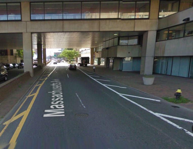
The next Google Street View in the image below is from July, 2011, showing a a recently-installed bike lane. The travel lanes now go straight. To allow a third lane to start earlier, bike lane stripes taper into the curb (!!). A very similar photo was posted by DotBikes (bicycling advocacy organization for the Dorchester section of Boston).
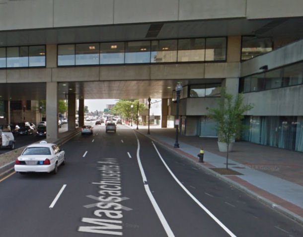
The Street View photo below is from a little farther along the street and was taken in November, 2011. The median barrier after the flyover is gone, and a left turn lane has replaced one for opposite-direction traffic. The upper sign on the second lamppost (red arrow) reads “left lane must turn left” but for the Google camera and for drivers who sit high in the cabs of their vehicles, a solar panel for a Hubway kiosk obscures the sign.
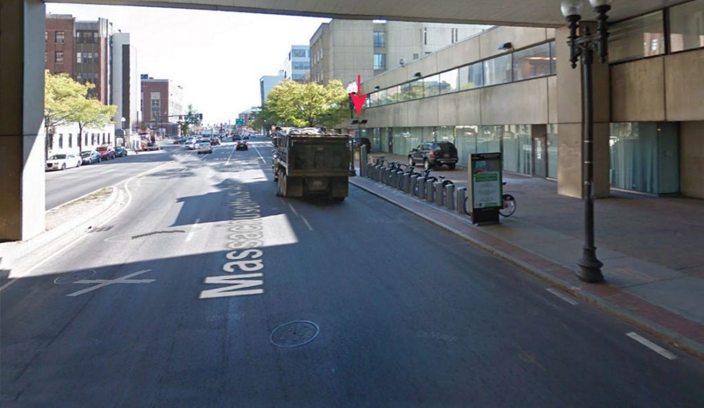
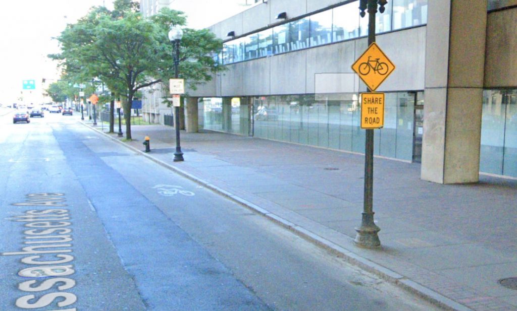
By October, 2012, the Hubway installation had been pulled away from the sign, and a bicycle sign with a Share the Road plaque had been installed. The shared-lane marking’s placement that follows advises that sharing the road is supposed to mean sharing a narrow lane with motor vehicles.
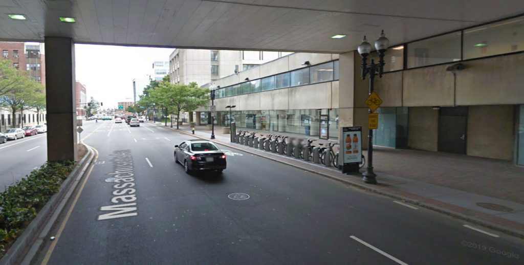
In 2013, the Hubway station was been removed. The tapered bike lane was still there in this view from May, 2014. This view shows the intent of the design, with the dashed line as the bike lane tapers down: motorists merge into the right-hand lane, pushing bicyclists to the curb. Bicyclists are encouraged to ride along next to the curb, though the curb lane is not wide enough for side-by-side lane sharing.
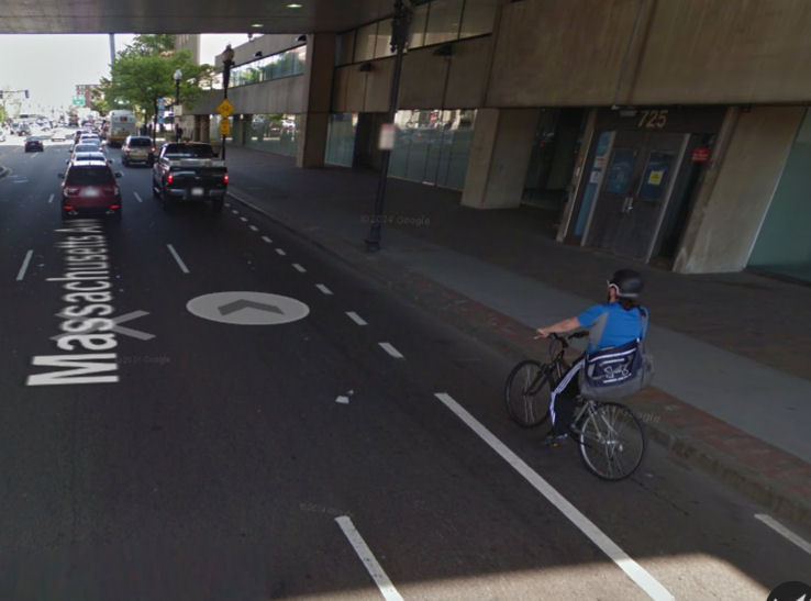
A little farther along, there was a “share the road” sign, followed by a shared-lane marking placed close to the right side of the lane. The Hubway station had been removed by September, 2013.
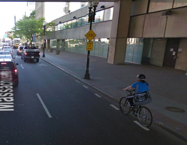
The design intent is quite clear here: where the bike lane ended, bicyclists were supposed to move over to the curb so motorists can overtake them in a lane which is too narrow for safe overtaking. This installation promoted unsafe edge riding through use of the shared-lane marking and share-the-road sign which are meant to promote bicyclists’ riding centered in the lane.
By August 2018, the bike lane had been extended as a travel lane. The Share the Road sign and shared-lane marking near the right-hand curb remained.
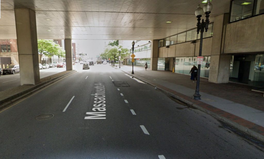
By August, 2019, all the markings except the shared-lane marking near the curb had been obliterated by paving following a storm-sewer project.
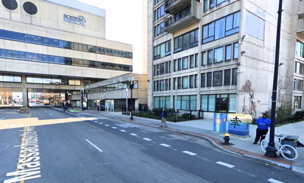
In April, 2020, a bicyclist was killed, struck by a truck when, as reported, walking his bicycle in the intersection of Massachusetts Avenue and Harrison Avenue. The way this occurred is unclear from news reports: another vehicle which left the scene may have been involved. The bulbout on the corner had existed since 2009 but had not been installed in 2007. What involvement it might have had in the fatality is unknown. By November 2020, a ghost bike had been placed. Note also the bike lane which passes through a bus stop. The implication is that bicyclists should wait behind stopped buses. This condition had existed ever since the bike lane was first installed. In the background, concrete barriers have been placed between the bike lane, now painted green at its start, and the next lane. A bicyclist on an e-bike is shown crossing Massachusetts Avenue at an odd angle. The tree near where the bicyclist is crossing was looking sickly in 2018 and had disappeared by August, 2018, thouh trees after the flyover still look healthy.
Here’s a closer view of the concrete barriers, the concrete barriers, which can damage motor vehicles and topple bicyclists in the bike lane into the lane where the motor vehicles travel.
In this Street View taken a few seconds later by the moving Google camera car, the barriers are more visible and the bicyclist is mounting the curb onto the sidewalk.
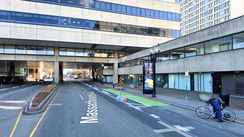
By October 2022, the concrete barriers had been replaced with flex posts, which can topple bicyclists in the bike lane into their path and which motor vehicles can push over. This had not changed as of August, 2024. Why? Maybe to make snowplowing possible by removing the flexposts in winter, maybe because of the hazard to motorists.
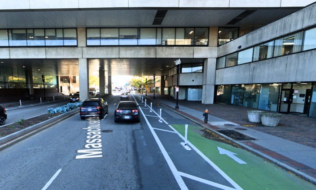
A better installation here would simply place shared-lane markings in the center of the right-hand lane. It’s also fair to ask why the sidewalks here have to be so unnecessarily wide. If you look back through the photos, you’ll see vehicles parked on the sidewalk including a large truck unloading. The sidewalk is so wide that these are no impediment to pedestrians. If not for those wide sidewalks, there would be room for side-by-side lane sharing. I suppose that it’s fair to ask where the trucks would unload, but actually there’s enough room for off-street loading zones too, the sidewalks are so wide.
Massachusetts Avenue ranks has a high crash rate street in Boston, but the two fatal bicycle crashes in recent years are from right-turning trucks: Anita Kurmann in 2015, George Clemmer in 2022 — many others too causing serious injury including one at Columbus Avenue on which I have reported and another two weeks earlier. (The crash at Massachusetts Avenue and Harrison Avenue, however, was a truck-pedestrian crash.) Every one of these crashes leads to a call for barrier-separated , “protected” bike lanes, although these do not offer any protection at intersections, and theyforce bicyclist to enter the intersection to the right of turning motor traffic. The Clemmer crash, with a right-turning truck from Massachusetts Avenue, led to a call for separated bike lanes on Huntington Avenue, into which the cyclist was turning. Two fatal collisions in Cambridge in the summer of 2024 occurred when trucks turned right across the path of bicyclists entering an intersection from a separated bikeway.

Leave a Reply
You must be logged in to post a comment.